Tour Scotland photographs and videos from my tours of Scotland. Photography and videography, both old and new, from beautiful Scotland, Scottish castles, seascapes, rivers, islands, landscapes, standing stones, lochs and glens.
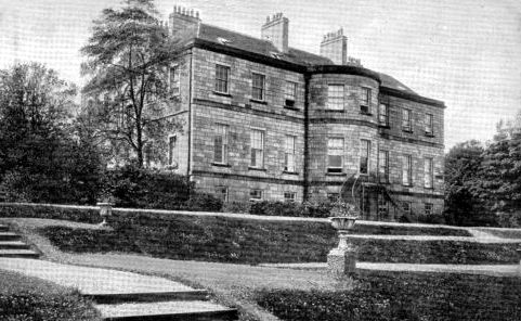
Old photograph of Laudervale House by Dunoon, Scotland. This Victorian mansion house was the home of Sir Harry Lauder. Originally named Gerhallow House, it was bought by Sir Harry Lauder and Lady Lauder from Douglas Granville Gossling on May 20, 1908. The couple disliked the existing name and in 1912 renamed it to the more personalized "Laudervale. " Lauder lived at the property from 1908 to the 1930s. After a fire, which burnt over half of it, it was left in a ruinous state until 1980 when both the house and the stable blocks were demolished. Much of the grounds were subsequently sold for housing development.
All photographs are copyright of Sandy Stevenson, Tour Scotland, and may not be used without permission.
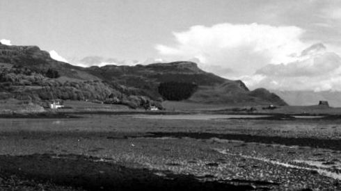
Old photograph of Isle of Canna, the westernmost of the Small Isles archipelago, in the Scottish Inner Hebrides of Scotland. A' Chill, situated to the north west of Canna Harbour was the main settlement until 1851 when the island was cleared. It was then under the ownership of Donald MacNeil's son Donald, who was a minor at the time. The post-clearance population is recorded as 57 in 1881, in which year MacNeil sold to Robert Thom, a ship owner from Glasgow. His more enlightened stewardship continued until 1938 when his family sought a sympathetic purchaser and sold to John Lorne Campbell. Campbell lived there until his death in 1996, gifting the island to the NTS in 1981.
Old photograph of Isle of Canna, the westernmost of the Small Isles archipelago, in the Scottish Inner Hebrides of Scotland
Old photograph of Isle of Canna, the westernmost of the Small Isles archipelago, in the Scottish Inner Hebrides of Scotland.
All photographs are copyright of Sandy Stevenson, Tour Scotland, and may not be used without permission.
Old photograph of crofters cutting Peats on South Uist, Scotland. South Uist was sold to Lt. Colonel John Gordon of Cluny in 1837 and the fortunes of the island's tenants went downhill from that point. He initiated Highland Clearances to make way for sheep farming, supplanting the crofters with farmers from the Borders, who brought flocks of Blackface sheep. As a result there was large scale emigration from the island.
All photographs are copyright of Sandy Stevenson, Tour Scotland, and may not be used without permission.
Tour Scotland photograph of Rannoch Moor in the Highlands of Scotland. Rannoch Moor is a large expanse of around 50 square miles boggy moorland to the west of Loch Rannoch in Scotland, where it extends into Perthshire, Lochaber in Highland, and northern Argyll and Bute.
Tour Scotland Winter photograph of Rannoch Moor in the Highlands of Scotland.
Old Tour Scotland late afternoon video from a train crossing Rannoch Moor on visit to the West Highland Railway Line in the Highlands of Scotland. The A82 road crosses through Rannoch Moor on its way to Glencoe and Fort William. Additionally, the West Highland Railway line crosses the moor. The railway rises to over 1300 feet and travels over 23 miles of moorland.
All photographs are copyright of Sandy Stevenson, Tour Scotland, and may not be used without permission.
Old photograph of Glasserton house in Dumfries and Galloway, Scotland. This Scottish house and gardens were built on the large estate on the orders of the Honorable Admiral Keith Stewart, the second surviving son of Alexander Stewart, 6th Earl of Galloway who was given the Barony of Glasserton in 1767. The Statistical Account gives in 1795 a detailed description of his agricultural improvements, based on continued raising of the traditional black cattle. He died in 1795, and was succeeded by his son, Rt Hon James Alexander Stewart-Mackenzie, but the house was let and the contents were sold. He sold the house and grounds in 1819 to Stair Hathorn-Stewart at the neighbouring Physgill estate. That which is now called " Woodfall Gardens " was a part of the Glasserton and Physgill estate which was sold some thirty years ago and are now on show to the public.
All photographs are copyright of Sandy Stevenson, Tour Scotland, and may not be used without permission.
Old photograph of Hunterston Castle by West Kilbride, North Ayrshire, Scotland. This Scottish castle is the historic seat of the chiefs of Clan Hunter. It is likely that the Hunters came to Scotland with David I of Scotland upon his invitation and were given lands named Hunter's Toune. In 1296 Aylmer le Hunter of the county of Ayr appears on the Ragman Rolls submitting to Edward I of England. A charter signed by Robert II of Scotland on 2 May 1374 has survived that confirmed a grant of land to William Hunter for his faithful service rendered and to be rendered to us in return for a silver penny payable to the Sovereign at Hunterston on the Feast of Pentecost. To this day the Laird of Hunterston, chief of Clan Hunter keeps silver pennies, minted in the reigns of Robert II and George V in case of a royal visit on the day appointed for payment of his rent. The William Hunter who received this charter is reckoned to have been the tenth Hunter of Hunterston. In earlier records both William Hunter and Norman Hunter appear using the Latin form of the name, Venator.
All photographs are copyright of Sandy Stevenson, Tour Scotland, and may not be used without permission.
Old photograph of the railway station in Catrine in East Ayrshire, Scotland. The station opened on 1st of September 1903, and closed on 1st of January 1917. It was subsequently reopened, but closed to passengers permanently on 3rd of May 1943. The Catrine Branch line left the former Glasgow, Paisley, Kilmarnock and Ayr Railway at Brackenhill Junction, a few miles south-east of Mauchline, and is now completely lifted.
Old photograph of the railway station in Catrine in East Ayrshire, Scotland.
All photographs are copyright of Sandy Stevenson, Tour Scotland, and may not be used without permission.
Old photograph of the railway station in Carrbridge, Badenoch and Strathspey, Scotland. The station was opened on 8th of July 1892 when the line to Aviemore opened. Services to Inverness commenced on 1st of November 1898. The station building is thought to be by the architect William Roberts, dating from 1898.
All photographs are copyright of Sandy Stevenson, Tour Scotland, and may not be used without permission.
Old photograph of cottages in Parton village on the banks of the River Dee in Dumfries and Galloway, Scotland. James Clerk Maxwell, born 13th of June 1831, died 5th of November 1879, lived at the nearby Glenlair House. He was a Scottish mathematical physicist. His most prominent achievement was to formulate a set of equations that describe electricity, magnetism, and optics as manifestations of the same phenomenon, namely the electromagnetic field. Maxwell's achievements concerning electromagnetism have been called the " second great unification in physics ", after the first one realised by Isaac Newton. Also buried in the graveyard is Elma Yerburgh, born 1864, died 1946, of the Thwaites Brewery family from Blackburn, who lived at nearby Barwhillanty.
All photographs are copyright of Sandy Stevenson, Tour Scotland, and may not be used without permission.
Old photograph of crofters cottages in Weisdale, Shetland Islands, Scotland. Weisdale was the scene of a series of evictions of crofters in favour of large scale sheep farming in the 19th century. Approximately three hundred and eighteen crofters were evicted from the Weisdale valley in what is described as the clearances.
All photographs are copyright of Sandy Stevenson, Tour Scotland, and may not be used without permission.
Old photograph of crofters cottages in Bixter, Shetland Islands, Scotland. Two miles south west of Bixter lies Staneydale Temple, a Neolithic hall containing a large oval chamber. Around it are ruins of houses, walls and cairns of the same period.
All photographs are copyright of Sandy Stevenson, Tour Scotland, and may not be used without permission.
Old photograph of the sculptured cross on ancestry visit to Isle of Oronsay, Inner Hebrides, Scotland. A sculptured cross in the grounds of Oronsay Priory a 14th century ruined Augustinian priory, probably on the same site as the original 563 building, and the Oronsay Cross, originally carved on Iona.
All photographs are copyright of Sandy Stevenson, Tour Scotland, and may not be used without permission.
Old photograph of cottages, cars and church in Kinloss located three miles from Findhorn, Moray, Scotland. Northeast of the village is Kinloss Barracks, formerly RAF Kinloss which opened on 1 April 1939. It is believed that 1,000 aircraft were dismantled at Kinloss, after the end of the Second World War. The Cistercian Kinloss Abbey was created in 1150 by King David. Under abbot Robert Reid the abbey became a centre of academic excellence in the 1530s. It now lies almost completely ruined.
All photographs are copyright of Sandy Stevenson, Tour Scotland, and may not be used without permission.
Old photograph of Carsaig Arches on the Ross of Mull in the south of the Isle of Mull, Scotland. These cliff formations are the result of erosion along the sea coast. They are formed by the erosion of Oolitic rock beds located to the west of the entrance to Loch Bay. Reached via a road from the Carsaig Pier, the track is strewn with volcanic rocks and boulders and involves about four miles of climbing to reach it.
All photographs are copyright of Sandy Stevenson, Tour Scotland, and may not be used without permission.
Old photograph of the Robert Stevenson lighthouse on the Isle of May in the Firth of Forth about five miles from Anstruther in the East Neuk of Fife, Scotland. This Scottish lighthouse was built on the island in 1816 by Robert Stevenson. and is an ornate gothic tower on a castellated stone building designed to resemble a castle, 79 feet high and with accommodation for three light keepers and their families, along with additional space for visiting officials. The new lighthouse started operating on 1 September 1816.
All photographs are copyright of Sandy Stevenson, Tour Scotland, and may not be used without permission.
Old photograph of cottages in Fetterangus located North of Mintlaw, Aberdeenshire, Scotland. The village of Fetterangus was established by James Ferguson, Lord Pitfour just over a mile north of his mansion house in 1752. The local area around the village is rich with prehistory and historical features. Somewhat to the south of Fetterangus are a number of prehistoric monuments including Catto Long Barrow, Silver Cairn and many tumuli. In the same vicinity of the Laeca Burn watershed is the point d'appui of historic battles between invading Danes and indigenous Picts.
Old photograph of cottages in Fetterangus located North of Mintlaw, Aberdeenshire, Scotland.
All photographs are copyright of Sandy Stevenson, Tour Scotland, and may not be used without permission.
Old photograph of a golfer on the Road Hole on the Old Golf Course in St Andrews, Fife, Scotland. This one of the one of the world's most famous golf holes. Golfers using the back tees cannot see where their tee shots land; which is not unusual except that they must take aim over a corner of The Old Course Hotel. Other than rough, the main hazard in front of the green is a sand trap known as the Road Hole Bunker. Over the back of the green, hazards include a tarmac roadway, as well as an old stone wall. Both are in play; a wayward shot can lead a player to take their next stroke off the roadway or to hit the face of the wall and take their chances with the ensuing bounce.
All photographs are copyright of Sandy Stevenson, Tour Scotland, and may not be used without permission.
Old photograph of cottages in Auchtermuchty, Fife, Scotland. Auchtermuchty was the setting for The Wife of Auchtermuchty, a comic Scots poem of the late Middle Ages. The town was also used as the location for Tannochbrae in the 1990s ITV series Dr. Finlay.
All photographs are copyright of Sandy Stevenson, Tour Scotland, and may not be used without permission.
Old photograph of Myres Castle by Auchtermuchty, Fife, Scotland. The history of this Scottish castle is intertwined with the nearby Falkland Palace, since Myres was the heriditary home of the Macers, or Sergeants of Arms, of Falkland. The word " myres " is associated with a boggy place; in fact, Myres Castle is located within fields and policies with marginal drainage. Further drainage improvements to the fields were made as late as the 1970s. There exists an attractive pond in front of the Castle, which also serves to collect runoff. The lands of the present Myres estate originally part of the extensive properties of the Earl of Fife, the Myres portion being conveyed by marriage to Robert, Duke of Albany. In the year 1425, Murdoch, the son of Robert, forfeited the holding to the crown. From that time until the 16th century, the tenant farmers rents are recording in the rolls of the Royal Exchequer, indicating continuing ownership of the king. The first recorded tenant of the south quarter of Auchtermuchty, known as " the myres ", was Robert Coxwell who resided at the Scottish Royal Court.
All photographs are copyright of Sandy Stevenson, Tour Scotland, and may not be used without permission.
Old photograph of Stair House in Ayrshire, Scotland. This late 16th or early 17th century house was the birthplace of John Dalrymple the Master of Stair, born 1648, died 8 January 1707, who was a Scottish noble who played a crucial role in the 1707 Treaty of Union between the Kingdom of Scotland and the Kingdom of England, that created the Kingdom of Great Britain. Dalrymple is most remembered for his part in the 1692 Massacre of Glencoe. In 1695, the Scottish parliament demanded an enquiry into the massacre, and when the report from the enquiry was complete, they voted that " the killing of the Glencoe men was murder ". Responsibility for the crime lay with the King's Scottish ministers, but King William was guilty of a " great breach of duty " in shielding the Master of Stair from any punishment beyond dismissal from the Secretaryship of State. He returned to government in 1700 as a member of the Privy Council of Scotland. The Master of Stair, was created first Earl of Stair in 1703 by Queen Anne.
All photographs are copyright of Sandy Stevenson, Tour Scotland, and may not be used without permission.
Old photograph of cottages, houses and people in Strichen village located eight miles from Fraserburgh, Aberdeenshire, Scotland. This Scottish village got its name from Lord Strichen. It is situated on the River Ugie at the foothills of Mormond Hill. The Strichen White Horse is constructed of quartz on Mormond Hill. Scotland's First Minister, Alex Salmond MSP, lives in a converted mill in the village with his wife Moira.
All photographs are copyright of Sandy Stevenson, Tour Scotland, and may not be used without permission.
Old photograph of Strichen House located eight miles from Fraserburgh, Aberdeenshire, Scotland. Strichen House, designed in 1821 in a commission for Thomas Fraser, 12th Lord Lovat, fell into ruin in 1954. As well as a country house it was variously used as a base for fishing, hunting, a hotel and an army barracks. Thomas Alexander Fraser, 12th Lord Lovat and 1st Baron Lovat KT, born 17 June 1802, died 28 June 1875, was a Scottish peer. He was also the 21st MacShimidh, the traditional Gaelic Patronym for the Chiefs of the Clan Fraser.
All photographs are copyright of Sandy Stevenson, Tour Scotland, and may not be used without permission.
Old photograph of Kinmundy House in Aberdeenshire, Scotland. South of the former weaver's hamlet of Durie in Buchan was the site of the now derelict Kinmundy House, once home to the Fergusons of Kinmundy. William Ferguson of Kinmundy, born 1823, died 1904, was Chairman of the Great North of Scotland Railway from 1879 to 1904. The original house was plundered and almost burnt by Gordon of Glenbucket's Highlanders in the Forty five, and only saved by the presence of mind of the Lady Kinmundy, whose husband was absent, and whose young son had been hurriedly despatched to a neighbouring farmhouse concealed in a clothes basket. She sent a message to the officer in command to the effect that it was strange conduct on the part of a gentleman so to treat a lady's house; that she had just been preparing some refreshment for his men when they set fire to the part of the house where it was to be served, and that if they wanted their dinner they had better put the fire out. The same good lady on another occasion, when a recruiting party were forcibly impressing the young men around, and some of them asked protection, is said to have put the house in a state of defence, and answered the summons to surrender the fugitives with the reply, " Her people had come there for safety, and safety they should have, and before they were got the house must be knocked down. "
All photographs are copyright of Sandy Stevenson, Tour Scotland, and may not be used without permission.
Old photograph of people by the Wishart Arch in Dundee, Scotland. Dundee became a walled city in 1545 during a period of English hostilities known as the rough wooing, Henry VIII's attempt to extend his Protestant ambitions north by marrying his youngest son Edward, Duke of Cornwall to Mary Queen of Scots. The Wishart Arch is thought to be the only remaining part of the wall. Mary maintained the alliance with the French, who captured Protestant opponents, including John Knox, at St Andrews Castle, in nearby east Fife, in July 1547. That year, following victory at the Battle of Pinkie Cleugh, the English occupied Edinburgh and went on to destroy much of Dundee by naval bombardment. The Howff Burial Ground, granted to the people of Dundee in 1546, was a gift from Mary.
All photographs are copyright of Sandy Stevenson, Tour Scotland, and may not be used without permission.
Old photograph of Lochhouse Tower near Moffat in Dumfries and Galloway, Scotland. Lochhouse Tower stands on low lying ground a mile South of Moffat, and was probably built in the 16th century by the Johnstones of Corehead, in Annandale. It was perhaps built about the time of the Act of Parliament of 1535; it is mentioned in 1567 as being occupied by a Johnstone. It is oblong on plan, with rounded corners. It measures 37ft by 27ft, with walls 6ft thick; the basement is vaulted. It stands three storeys high, with a flat roof; only the South gable of the garret remains. The interior has been much altered, though some original details have been revealed by recent work.
All photographs are copyright of Sandy Stevenson, Tour Scotland, and may not be used without permission.
Old photograph of Neil Armstrong on a visit to Langholm in Dumfries and Galloway, Scotland. In 1972, astronaut Neil Armstrong, a descendant of the Clan Armstrong, was welcomed to the town, and made the first freeman of the burgh. He happily declared the town his home: " My pleasure is not only that this is the land of Johnnie Armstrong, rather that my pleasure is in knowing that this is my home town and in the genuine feeling that I have among these hills among these people. "
All photographs are copyright of Sandy Stevenson, Tour Scotland, and may not be used without permission.
Old photograph of Kytra Lock on the Caledonian Canal near Fort Augustus and Loch Ness, Scotland. The Caledonian Canal connects the Scottish east coast at Inverness with the west coast at Corpach near Fort William. The canal was constructed in the early nineteenth century by Scottish engineer Thomas Telford. Thomas was a Scottish civil engineer, architect and stonemason, and a noted road, bridge and canal builder. After establishing himself as an engineer of road and canal projects in Shropshire, he designed numerous infrastructure projects in his native Scotland, as well as harbours and tunnels.
All photographs are copyright of Sandy Stevenson, Tour Scotland, and may not be used without permission.
Tour Scotland January afternoon video of the Scottish Charity Air Ambulance helicopter landing at Perth Airport in Scone by Perth, Perthshire, Scotland. The ambulance returning from an emergency flight and visit to the Scottish Borders. Scotland’s Charity Air Ambulance is a registered charity and receives no government or lottery funding. They rely 100% on public donations.
All photographs are copyright of Sandy Stevenson, Tour Scotland, and may not be used without permission.
Old photograph of the Holes of Scrada, Northmavine, Shetland Islands, Scotland. The Holes of Scrada, stretching 132 yards inland were created when the roof of a deep and narrow sea cave collapsed. Northmavine is a peninsula on the northernmost part of the Shetland. Northmavine is in the north west of the island, and contains the villages of Hillswick, Ollaberry, and North Roe.
All photographs are copyright of Sandy Stevenson, Tour Scotland, and may not be used without permission.
Old photograph of Barony Castle at Eddleston located four miles North of Peebles in the Borders of Scotland. The remains of a 16th century tower house, built by the Murrays of Blackbarony, form the oldest part of the building. Sir Alexander Murray, 2nd Baronet, purchased the nearby estate of Cringletie in 1666. Sir Archibald Murray, 3rd Baronet was a soldier and from 1689 served as " Sole Master of Work, Overseer, and Director-General of their Majesties' buildings " to King William II and Queen Mary II, filling the post which had been vacant since Sir William Bruce's dismissal in 1678. During the Second World War, Black Barony at Eddleston near Peebles was requisitioned for military use and in 1942 became The Polish Higher Military School used for staff officer training. Poland had been invaded by Nazi Germany, Soviet Russia and Slovakia. Many Polish military personnel escaped via Romania to France and the United Kingdom. After the Fall of France in May 1940, many more Polish forces arrived in the UK. Most Polish land forces were deployed to Scotland and so Black Barony and other sites were requisitioned for the use of the Polish forces stationed in Scotland. These included the 10th Armoured Cavalry Brigade commanded by General Stanisław Maczek, which formed the nucleus of the 1st Polish Armoured Division organised in February 1942. Polish forces were initially deployed throughout Scotland for the defence of Scotland's East Coast against possible invasion by Nazi German forces in Norway and Denmark. The Poles provided the defence of many areas and vital services such as patrolling and guarding beaches, ports, estuaries, airfields and radar sites. They operated anti-aircraft guns and barrage balloons and installed tank obstacles.
All photographs are copyright of Sandy Stevenson, Tour Scotland, and may not be used without permission.
Old photograph of Garrion Bridge located eighteen miles South East of Glasgow, Scotland. This Scottish village has grown around a main river crossing of the River Clyde in Lanarkshire. The area spans both sides of the river, with some of the houses actually located in South Lanarkshire. The success of the Clyde at the beginning of the Industrial Revolution was driven by the location of Glasgow, being a port facing the Americas. Tobacco and cotton trade began the drive in the early 18th century. However, the shallow Clyde was not navigable for the largest ocean going ships and cargo had to be transferred at Greenock or Port Glasgow to smaller ships to sail upstream into Glasgow itself.
All photographs are copyright of Sandy Stevenson, Tour Scotland, and may not be used without permission.
Tour Scotland music video recommendation of Ross Ainslie playing Wide Open. Ross Ainslie is one of Scotland’s finest traditional musicians and composers. He was born in 1983 in Perthshire, Scotland.
All photographs are copyright of Sandy Stevenson, Tour Scotland, and may not be used without permission.
Old photograph of cottages in Presnerb in Glenisla, Angus, Scotland. Glen Isla is the most westerly of the Angus Glens, and the only one that is a through route for cars. The Glen is thirty two miles north west of the city of Dundee. The countryside is mainly rough grassland and heather. The River Isla runs through the heart of the glen.
All photographs are copyright of Sandy Stevenson, Tour Scotland, and may not be used without permission.
Old photograph of cottages in Kinbuck village located four miles North of Dunblane, Scotland. Kinbuck was the location of the retreat of the Jacobite troops under the Earl of Mar following the Battle of Sheriffmuir on 13th of November 1715. Nearby is Kinbuck Bridge as well as Cromlix House, former seat of Viscount Strathallan and the Clan Drummond family.
All photographs are copyright of Sandy Stevenson, Tour Scotland, and may not be used without permission.
Old photograph of cottages in Insh village located four miles East of Kingussie, Scotland. This Scottish village is probably best known as the location of the RSPB Insh Marshes Wildlife Reserve. It is close to Loch Insh where it is possible to take part in various watersports from Winsurfing to Sailing. There are lovely walks in the woods around Insh too.
All photographs are copyright of Sandy Stevenson, Tour Scotland, and may not be used without permission.
Old photograph of Belses located South of St Boswells in the Scottish Borders, Scotland. Belses was the site of a railway station on the former Waverley Line, a double track railway which linked Edinburgh with Carlisle. The NBR, North British Railway closed in 1969. The North British Railway was a British railway company, based in Edinburgh. It was established in 1844, with the intention of linking with English railways at Berwick. The line opened in 1846, and from the outset the Company followed a policy of expanding its geographical area, and competing with the Caledonian Railway in particular.
All photographs are copyright of Sandy Stevenson, Tour Scotland, and may not be used without permission.
Tour Scotland January video of the Kingdom Of Fife Lifeboat on visit to Pittenweem in the East Neuk of Fife, Scotland. The Mersey Class Lifeboat is designated as a Fast Carriage Lifeboat though it is also capable of being launched down a slipway. This is the area in which I was raised in Scotland.
All photographs are copyright of Sandy Stevenson, Tour Scotland, and may not be used without permission.
Tour Scotland January video of the Kingdom Of Fife Lifeboat on visit to Anstruther in the East Neuk of Fife, Scotland. This is the town in which I was raised in Scotland.
All photographs are copyright of Sandy Stevenson, Tour Scotland, and may not be used without permission.